
Matching voters with their ballots
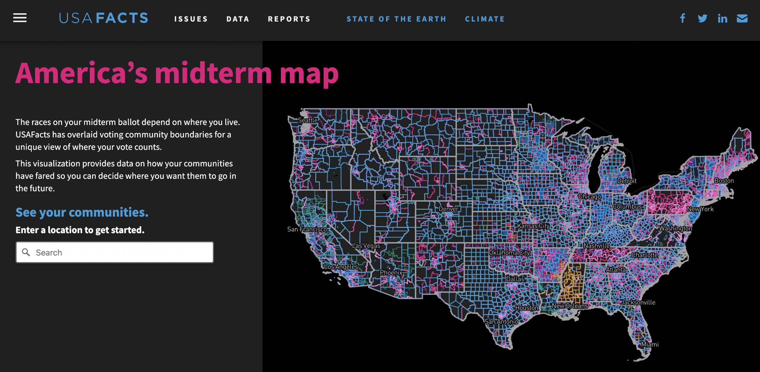
Image: usafacts.org
Introduction
How do shapefiles and data mapping relate to you as a voter this election season?
Answers are found through USAFacts’ midterm map, a staggering visualization of America’s voting districts and election positions. USAFacts used BallotReady’s latest GIS data to map out every single district boundary for federal, state, local, and municipal levels showing the complexity and volume of this data.
By overlaying voting community boundaries with data from other areas such as education and environment, the map helps you visualize where your votes counts and explore how communities are faring.
BallotReady’s comprehensive GIS data (updating following the recent 2020 redistricting) powers tools like this that enable exploration of election patterns and trends that occur over time within these digital boundaries—including election coverage for the smallest county in the US by population.
Let’s outline the application of shapefiles this election season.
Explaining shapefiles and our coverage
A shapefile is a common format for storing vector data used in GIS (geographic information system) mapping. Shapefiles as digital boundaries can be used in determining recent election results, measures, and voting precinct coverage.
In 2020, following the census, districts were redrawn and shapefiles had to be recollected and implemented to reflect updated ballots for voters.
Interactive visualizations like USAFacts’ midterm map demonstrate the scope of this work and are useful for examining patterns in election politics, vote totals, turnout, ballot measures, as well as connecting voters with their elected officials.
This year, our ballot matching is so detailed that 90% of voters have access to their precise county and city commissioner subdistricts when they access BallotReady’s data.
Insanely impressive data work.
The extent of down-ballot position data

Image: texashistory.unt.edu
Every position matters
No matter the size, every county deserves recognition. BallotReady’s researchers collect information for as many counties as possible.
Local races determine what day-to-day life looks like the most. In counties where populations are small, rural votes are powerful—from local to national levels.
Our data covers Loving County, Texas—the least-populous county in the US, with 64 residents in the 2020 census. BallotReady covered candidates in Loving County for multiple election cycles, including positions up this November such as:
Loving County Commission, Precinct 4
Loving County Commission, Precinct 2
Loving County Justice of the Peace
Loving County Sheriff
Loving County Judge
Edge cases and more edge cases

An example of the complexity of geofences in BallotReady’s database is found in an Illinois edge case concerning judgeships:
As it turns out, during redistricting years Illinois retention judges can choose to run for either their original district, or the district they're moving to.
In the upcoming Midterm election, Judge Joseph Birkett is running for retention in district 2, but will be appear on the ballot for district 3 in Illinois due to changes in redistricting. This discrepancy was flagged by a local Illinois customer and was confirmed both by the county clerk office and staff research into the state statues.
Edge cases like these challenge BallotReady’s data experts to find solutions to present as accurate a ballot as possible for Illinois voters.
Conclusion
As digital boundaries, shapefiles can be used in determining recent election results, measures, and voting precinct coverage
BallotReady’s down-ballot positions data is comprehensive—consider Loving County, Texas
Our experts navigate the complexity of geofences in our database to present voters with highly accurate information
This 2022 midterm election, vote informed on your entire ballot. Check your voter registration at ballotready.org and schedule a discovery call to learn more about how our tools turn out voters.
Browse ballot and elected official information by state
Alaska Alabama Arkansas Arizona California Colorado Connecticut District of Columbia Delaware Florida Georgia Hawaii Iowa Idaho Illinois Indiana Kansas Kentucky Louisiana Massachusetts Maryland Maine Michigan Minnesota Missouri Mississippi Montana North Carolina North Dakota Nebraska New Hampshire New Jersey New Mexico Nevada New York Ohio Oklahoma Oregon Pennsylvania Rhode Island South Carolina South Dakota Tennessee Texas Utah Virginia Vermont Washington Wisconsin West Virginia Wyoming
Enter your address below to access our data and view your personal ballot, no matter how big your county is.